Richtersveld Wildrun
Tuesday, 2 June, 2015 - 07:00 to Friday, 5 June, 2015 - 17:00
DAY 1: SENDELINGSDRIF to 'DIE KOEI'
Distance: 38.8km
Vertical gain: 948m
Aide station: 22km (cut-off time)
Aide station: 22km (cut-off time)
WTG: ORANGE 8A What's this?
From Sendelingsdrif (meaning 'Missionary's crossing') the route heads out in a south-west direction towards a very distinct series of five mountains called the 'Vyf Susters' (Five Sisters). The trail is fast in this section and pretty soon you will be clicking through the kms. Ducking in behind the Vyf Susters, the route follows a series of valleys behind the almost identical series of mountains, before the scene opens up onto the 'Grasvlakte'. At 22km you will reach your first aid-station of the event, and a welcome refill. From here, you will start the wind up to the top of 'Helskloof Pass' (Hell's Valley Pass) on 4x4 track. In summer, this place is devastatingly hot (50ºC+), so be thankful for the cool of winter! Taking a sharp left on the top of the Numeesberge, the route heads north and starts to undulate downward, before taking the last drop into 'Die Koei' and your first camp of the day.
Overall, the terrain to the base of Helskloof is fast and mostly non-technical. The climb is of course tough, but on run-able gradient for those who have done their hill training! From the summit, the hard work is over and you can enjoy the magical views into the heartland of the Richtersveld. Now that you have broken over the Numeesberge, you have earned the right to cruise the inner sanctum!
- See more at: http://www.wildrun.com/event/richtersveld/route#sthash.t4x9ZJPw.dpuf
DAY 2: 'DIE KOEI' to HAKKIESDORING
Distance: 36km
Vertical gain: 663m
Aide station: 19.5km (cut-off time)
WTG: GREEN 9A What's this?
Out of 'Die Koei', the route slots into the upper reaches of the 'Abiekwarivier', before ducking-off to climb up and over a ridgeline that runs off the 'Paradysberg' and then drops into 'Rosyntjieswater' (Raisin Water). From here, the valley opens up as we run between the magnificent 'Vandersterrberge' to the south and the 'Tswayisberge' to the north and into 'Armmanshoek' (Poor man's corner) aid-station. From Armmanshoek, the route climbs to the 'Tswayisberge' saddle before the long descent into the 'Ganukouriep' river valley and down to the finish of day two at 'Hakkiesdoring' (hook thorn).
This day, you will touch onto the slopes of the big mountains of the Vandersterrberge and get a real feeling for this remote and truly wild area of the Richtersveld. At the junction of the ‘Ganukouriep’ river valley there is an option of an extra dead-leg return to the most magnificent amphitheatre - a fortress of rock towering 150-200m straight up with a flat and sandy bottom. However, this is a tough return leg and only for those strong of legs!
- See more at: http://www.wildrun.com/event/richtersveld/route#sthash.t4x9ZJPw.dpuf
DAY 3: HAKKIESDORING to DE HOOP
Distance: 36.3km
Vertical gain: 758m
Aide station: 13.6km (cut-off time)
WTG: GREEN 10B What's this?
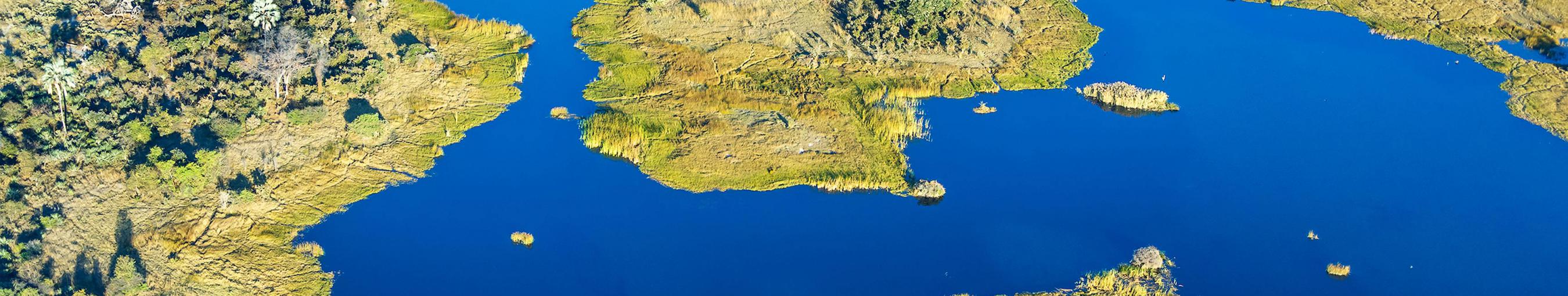
To start off, you will belt down into the Ganukouriep river bed, before turning up eastwards towards the central plateau. After exploring some pretty neat little granite gullies (a sign of things to come later in the day) the route tops out on the edge of the open expanse that is the 'Springbokvlakte' (Springbok flats). This magnificent plateau, sitting at an average of 600m above sea level, used to teem with millions of springbok that migrated here for the sweet grasses after good rains (relatively speaking!). Running these plains is an experience in itself, the enormity of space all-encompassing. In front of you, the granite boulder towers of the fractured Tatasberg range mark the end of the plains and the opening of a very different chapter. From the aid-station at 13.6km, you enter onto the giant granite sheets and clamber up through giant boulders to one of the smaller of the Tatasberg summits. From the top, you'll make your way through this veritable boulder graveyard, to the floor of 'Pypkloof' (Pipe Valley). You are now on the run down to the Orange River, the steep valley floor gradient making you feel like a rocket ship! From the top of the Tatasberg to the Orange River is almost 1000m of descent over less than 10km! What lies on either side of you belies belief - I say no more! Once you hit the mighty Orange River and the lush vegetation that comes with it, the route turns westwards and runs the outside bend of the river to the magnificent riverside camp of De Hoop.
There is one adventurous 'sneak' for the brave that cuts 2km off the day’s total - more about that at briefing. This day will no doubt scramble the mind with the sheer diversity of experiences: from the wide open plains of the Springbokvlakte to the granite sheets and tricky boulders of Tatasberg and the sheer magnificence of the Orange River valley - with nothing around but wilderness. Look out for Fish Eagles as you hit the river!
- See more at: http://www.wildrun.com/event/richtersveld/route#sthash.t4x9ZJPw.dpuf
DAY 4: DE HOOP to SENDELINGSDRIF
Distance: 38.3km
Vertical gain: 1003m
Aide station: 17.5km (cut-off time)
WTG: GREEN 10B What's this?
Leaving the sanctuary of the Orange River means climbing, and so the day starts by meandering up the lower tight section of 'Kookrivier' (Boiling River). Soon it opens up again into the plains of the amphitheatre - but deceivingly, the route tucks back into the winding gorge of Kookrivier again before making the final approach to the top of 'Akkedispas' (Lizard Pass), and the aid-station at 17.5km. Don't be fooled by what seems to be a job done! The best is for last... Dropping down the Akkedispas, you will be pleased to see we stay on the 4x4 track at this point as you wind down through tortured terrain. At the bottom of Akkedispas, the route turns and follows more goat trails up and onto the 'Halfmens' (Half-man) plateau. From the plateau, you'll make your way onto Halfmens ridge as the land around you drops away. Negotiating the sandstone gargoyles and shattered shale bands, while surrounded by the unique Halfmens plants will be a memory you will never forget. From Halfmens ridge, you'll carefully descend over the most technical ground thus far, to the valley floor and the start of the Crystal Fields. Imagine the world’s best golf course covered in bands of intermittent white quartzite, black dolerite, pink quartzite, grey shale and spiced with red oxide soil. Truly mesmerising. Tucking in and out of an exciting array of gullies, followed by a final dash to the Reserve headquarters finishes off the Richtersveld Wildrun!
- See more at: http://www.wildrun.com/event/richtersveld/route#sthash.t4x9ZJPw.dpuf
Event Venue:
/Ai/Ais-Richtersveld Transfrontier Park
Organiser:
Wildrun and SANParks
Event Type: