Translate
News
Witsieshoek host ARU Climate Research Facility: Alpine Research in a Transfrontier Mountain System
19 November 2025
Name: Witsieshoek Community Conservation Area (WCCA)
Countries: South Africa, with ecological linkages into Lesotho through the Maloti–Drakensberg mountain system
Surface Area: Core research zone of 256 ha (Alpine Research Lease), within a larger community-owned escarpment landscape
Year of formal TB agreement: 2001 (Maloti–Drakensberg Transfrontier Conservation and Development Project established)
International designations: Adjacent to the UNESCO uKhahlamba–Drakensberg Park World Heritage Site’s extended ecological corridor; within the broader Maloti–Drakensberg Transfrontier Conservation Area
Case Study
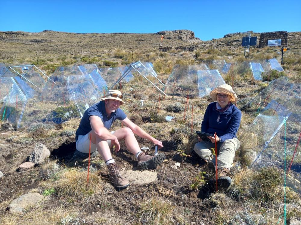
High on the escarpment where the Free State meets the Maloti-Drakensberg, the Batlokoa community has taken a deliberate step for a communal alpine landscape: they granted the University of the Free State’s Afromontane Research Unit a long-term research lease over 256 hectares of summit terrain. The agreement, negotiated by Transfrontier Parks Destinations, Witsieshoek's management company, gives scientists predictable, multi-year access to high-altitude grasslands that are both ecologically fragile and globally relevant for climate modelling. That stability of tenure, more than any single dataset, is what positions Witsieshoek as a meaningful contributor to the transfrontier conservation community.
The area now functions as a high-elevation climate research facility. A network of weather stations, placed across a steep altitudinal gradient, is generating one of the region’s most detailed climate datasets. Together with ongoing bioblitzes, soil assessments and postgraduate wildlife research, these observations allow scientists to track how alpine ecosystems respond to shifts in temperature, frost cycles and rainfall. The remote Alpine Base provides the practical platform for this work, enabling year-round monitoring in terrain that is often inaccessible in winter.
The significance extends beyond the WCCA boundary. Witsieshoek lies at the northern anchor of a mountain corridor linking South Africa and Lesotho. Insights from its climate and ecological data feed into regional conversations about rangeland stability, montane water security and the resilience of species such as the mountain reedbuck and eland. In these high-lying ecosystems, early signals of change matter: the alpine meadows are among the first to show stress under warming conditions.
In 2025, the ARU’s South African Mountain Conference and the Royal Indaba brought researchers, traditional leadership and regional conservation bodies into closer dialogue. These gatherings strengthened the understanding that the research is not external to community authority but hosted on community land under clear governance arrangements. That alignment is still evolving, but it has already created a credible foundation for the next decade of planning. Future rangeland restoration, eco-ranger training and potential rewilding efforts will draw directly from the longitudinal datasets now underway.
Witsieshoek offers a grounded model for TFCAs: a community-owned mountain landscape hosting stable, long-horizon climate research that can guide regional conservation choices before ecological thresholds are crossed. It shows how traditional land tenure and sustained scientific commitment can reinforce one another, producing knowledge with value beyond the horizon.
For more information contact: Eleanor Muller on eleanor@tfpd.co.za
More information: https://www.tfpd.co.za/